Sierra de Grazalema Natural Park
Designated a Unesco Biosphere reserve in 1977, the Sierra de Grazalema was declared the first natural park in Andalucia in 1984 and is one of Spain's most ecologically outstanding areas. The 51,695 ha park is famous for its spectacularly rugged limestone landscape of cliffs, gullies, caves and gorges. By far the most impressive gorge is Garganta Verde, with its exceptional griffon vulture colony and rocky walls that tower vertically for 400m. Andalucia's largest cave system is also here, the Hundidero-Gato with its biggest cavern measuring 4km long and an entrance of 60m tall.
The region is well known for being the rainiest place in Spain, with an annual rainfall of 2,200mm, which means that the 1,300 Mediterranean plant species that have been registered here, many of them endemic and some of them unique to the Sierra, flourish. There is a magnificent and well preserved forest of the rare Spanish fir, a relic from the Tertiary period, in the Sierra del Pinar on the slopes of Cadiz province's highest peak at 1,654m, El Torreón.
Dotted around the sierra are attractive pueblos blancos (white villages), the one in the most dramatic setting being Grazalema, which nestles between the two rugged peaks of Pico del Reloj and the Pico de San Cristóbal. Other picturesque pueblos blancos include Cortes de la Frontera, El Bosque, Zahara de la Sierra, Benamahoma.
-->Around 3,000ha of the park is called an Área de Reserve, with the most fragile ecosystems, Spanish fir forests and black vulture colnies. Conservation measures are more strict than the rest of the park and visits are controlled in terms of dates and numbers. At times when fire risks are greater (July to September) walks to this area are closed. For walks in the rest of the Area de Reserve, except for Sendero Garganta Verde, you must go with an authorized Turismo Activo company (details from the information offices listed in the "information" section below). For the rest of the year, you need to obtain permits from the El Bosque information office.
High rainfall and a limestone landscape mean that the water courses and springs are plentiful. The principal rivers are the Guadalete, Guadiaro, Tavizna and Ubrique.
Information
There is a Centro de Visitantes (visitors' centre) in Cortes de la Frontera (952 154 599), with information on geology, flora and fauna of the park.
In El Bosque is located the main park office (956 727 029), which has maps, walking routes and issues permits for certain protected for walks.
In Grazalema is located information office (956 132 225) that has walking maps and can obtain walking permits from the El Bosque office.
Access
The park is easily accessible by car or on foot. The main roads crossing the Sierra de Grazalema are the east west A-372 Ronda - Grazalema - Puerto Boyar (Boyar Pass) at 1.103m - Benamahoma - El Bosque road, and the A-374 Grazalema - Villaluenga del Rosario - Ubrique road. The A-373 also links Ubrique with El Bosque on the western edge of the park. South from Zahara de la Sierra over the Puerto de las Palomas (pass) at 1.180 to Grazalema is the winding CA-9104, while the MA-8403 links Cortes de la Frontera to Benaoján.
Villages nearby:
Benamahoma
Benaoján
Cortes de la Frontera
El Bosque
Grazalema
Montejaque
Ubrique
Villaluenga del Rosario
Zahara de la Sierra
back to Natural Parks of Cadíz
Walking guide books by Guy Hunter Watts
Buy walking guide books by Guy Hunter Watts
"Walking in Andalucia" by Guy Hunter Watts
 Walking in Andalucía is a 260 page full colour guide to some of the very best walks in southern Spain, taking the walker on 34 routes - all starting and most finishing in beautiful villages - in the Natural Parks of Grazalema, La Alpujarra, Cazorla, Los Alcornocales, Aracena, and La Axarquia. Many of the full and half day walks are virtually unknown even though they are a short drive from the Costa del Sol. Even though more and more people are beginning to walk Spain's southern sierras, most of the routes remain blissfully undiscovered. Guy says, 'If you decide to head for the hills with my guide you can be sure of two things: you will be walking through areas of great natural beauty and you will meet with other walkers.'
Buy a printed or eBook copy online direct from publishers Walking in Andalucia.
"Coastal walks in Andalucia" by Guy Hunter Watts
 45 great coastal walks close to Andalucia's Mediterranean and Atlantic coasts. Discover the best hiking trails close to Vejer, Caños de Meca, Conil, Tarifa, Bolonia, Gibraltar, Casares, Estepona, Marbella, Istán, Mijas, Benalmádena, Alhaurín, Cómpeta, Fuengirola, Nerja, Maro and Almuñecar. Talk to most people about the coast of Andalucía and they’ll picture the small swathe of seaboard that runs from Torremolinos to Estepona, the heartland of what is commonly sold as the Costa del Sol. First associations are of crowded beaches, busy coastal roads and blocks of holiday apartments. Few amongst them will conjure up visions of the mighty chain of mountains, the tail end of the Sierra Subbética, which rises up a few kilometres back from the sea. Nor do they tend to evoke the wilder beaches of the Costa de la Luz or the footpaths that run just a few metres from the Atlantic surf.
Buy a printed or eBook copy online direct from publishers Coastal Walks in Andalucia.
"The Andalucian coast to coast walk " by Guy Hunter Watts
 A stunning 21 day, 435 kilometre trail that links the Mediterranean with the Atlantic. The walk passes through six of Andalucia's Natural Parks and protected areas via its most beautiful mountain villages. Far more than a long walk, this on-foot odyssey can lead you to the heart of southern Spain's magnificent sierras and on a life-changing journey of discovery. One of the best things about the simple act of walking is the sense of reconnecting with Nature and the Big Wide World. We've been moving around on two feet for a very long time yet still, in the simple act of putting one foot in front of the next and moving across landscape, it seems that we reassert our identity. Day to day worries fall into insignificance, or rather true significance, when we get out into the mountains and walking is about a lot more than taking exercise.
Buy a printed or eBook copy online direct from publishers The Andalucian Coast-to-coast Walk.
"Walking the Mountains of Ronda and Grazalema" by Guy Hunter Watts
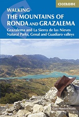 The dramatically situated town of Ronda can make a great base for a walking holiday in the mountains of Andalucía, as can any one of the picturesque 'pueblos blancos' (white villages) that nestle among the surrounding hills. This guidebook presents 32 mainly circular walks in the Ronda region, covering the town and its environs, the Natural Parks of La Sierra de Grazalema and La Sierra de las Nieves (both UNESCO biosphere reserves), and the Genal and Guadiaro Valleys. Clear route description is illustrated with mapping, and the route summary table and 'at a glance' information boxes make it easy to choose the right walk.
Buy a printed or eBook copy online direct from publishers Walking the Mountains of Ronda and Grazalema.