 |
| AXARQUIA The Walk of the Moor & his parrot |
THE WALK OF THE MOOR AND HIS PARROT
Frigiliana circular
Distance: 12 kms
Time Required: 4.5 hours
Rating: Medium
Map: 1:50000 Vélez-Málaga (1054)
Water: No springs on the walk
This half day ramble has an astonishing variety of scenery considering that you're never more than 5 kilometers from Frigiliana. From the village you drop down into the spectacular gorge of the Río Higuerón. After cutting north along the river a dramatic path (the final section of the Limán Trail which is also described in this book) leads up the gorge’s eastern side before cutting south along the top of a ridge to La Cruz de Pinto, a hilltop shrine dedicated to La Virgen del Carmen. You then loop back down to the gorge where you follow a path through one of its narrowest sections before the final steep pull back up to Frigiliana. You could pack long trousers for the rather overgrown middle section of the walk. Remember that the path through the gorge on the walk's final section can be dangerous after heavy rain: you'll need to take a view. If in doubt head straight across the river at waypoint 13 then climb the track which arcs up the western side of the gorge. You can then return to the Plaza del Ingenio along the Frijiliana - Nerja road.
The Route of the walk
This walk begins in Frigiliana in the square at the entrance to the village, La Plaza del Ingenio. With your back to a series of tiled pictures head down the hill then cut left along the road that runs to the right of the Unicaja bank signposted Río Higuerón. This concreted road loops steeply down to the river. Cross to its eastern bank then swing left on a broad, pebbly track. You soon pass a large water deposit, just to the left of the track, and then a small white hut. Just beyond the hut you reach a sign for Sendero de la Fuente del Esparto, 5.5 kms. Here cut right on a narrow path with climbs steeply up the side of the gorge to the top of the pass (35 mins).
Continue for just a couple of metres beyond the pass then cut right off the footpath at a small cairn: ignore the marker post pointing left in the direction of the Fuente del Esparto. You pick up a narrow path which leads up to the highest point of the ridge. Here bear left and continue along the apex of the ridge. Ahead in the distance you should be able to spot a pylon and, just behind it, the narrow footpath that will later lead you up to the Cruz de Pinto. Faint red, blue and yellow waymarking, as well as cairns, help you to plot the correct course.
You reach a dip in the ridge where the path angles right then runs on just to the right of the ridge's highest point. Soon you pass a massive circular cairn. Continuing along the ridge you come to a second large cairn where the path divides. Take the left fork and continue along the top of the ridge. Shortly you descend and pass immediately left of a pylon. The path angles right then reaches a fork where a path angles left, a track right. Cut left on the path which climbs up the left side of the ridge. After a steep ascent you arrive at La Cruz de Pinto (1hr 5 mins).
From this high vantage point there is an amazing 360 degree panorama of the sea, the coastal villages, Frigiliana and, to the north, the crumpled massif of the Sierra de Almijara. Facing the north side of the shrine, and the small black door protecting its votive offerings, cut east along the ridge for about 40m then swing right and pick up a path which leads down the hill's southern side. After descending for about 100m it passes left of a rocky outcrop then cuts right through a small col then descends steeply through the valley back down into the Higuerón valley where, after approximately 10 minutes, it reaches a track by a sign for Parque Natural. Here bear left and descend for approximately 200m to a point where the track that you've been following converges with three more. Here loop sharply right onto the most westerly (lower) of the tracks which climbs slightly before levelling. A line of telegraph posts runs beside the track. Soon you pass Cortijo Floreana. The track begins to descend, passing by a number of small houses/farms and groves of olives and avocado, then finally a small horse stable before it reaches the fertile valley floor (1 hr 35 mins).
Cut right just before you reach the Higuerón and head along its right bank. You soon pass just left of a red-tiled building. The indistinct path loops back and forth across the river and then, as the gorge narrows down, climbs along the stream's east bank via a steep stone staircase beyond which it descends steeply for a short distance. The path, cobbled in parts, passes a spring (often dry) then continues to loop back and forth across the river. You eventually reach the point where you first crossed the Higuerón at the beginning of the walk. Here cut left across the river and retrace your footsteps back up to your point of departure (2 hrs 20 mins).
It would be a shame not to stick a euro in the box of a rather bizarre kiosk in the square and listen to a Moor, and his parrot, discussing the finer points of Andalusian history.
Walking guide books by Guy Hunter Watts
Buy walking guide books by Guy Hunter Watts
"Walking in Andalucia" by Guy Hunter Watts
 Walking in Andalucía is a 260 page full colour guide to some of the very best walks in southern Spain, taking the walker on 34 routes - all starting and most finishing in beautiful villages - in the Natural Parks of Grazalema, La Alpujarra, Cazorla, Los Alcornocales, Aracena, and La Axarquia. Many of the full and half day walks are virtually unknown even though they are a short drive from the Costa del Sol. Even though more and more people are beginning to walk Spain's southern sierras, most of the routes remain blissfully undiscovered. Guy says, 'If you decide to head for the hills with my guide you can be sure of two things: you will be walking through areas of great natural beauty and you will meet with other walkers.'
Buy a printed or eBook copy online direct from publishers Walking in Andalucia.
"Coastal walks in Andalucia" by Guy Hunter Watts
 45 great coastal walks close to Andalucia's Mediterranean and Atlantic coasts. Discover the best hiking trails close to Vejer, Caños de Meca, Conil, Tarifa, Bolonia, Gibraltar, Casares, Estepona, Marbella, Istán, Mijas, Benalmádena, Alhaurín, Cómpeta, Fuengirola, Nerja, Maro and Almuñecar. Talk to most people about the coast of Andalucía and they’ll picture the small swathe of seaboard that runs from Torremolinos to Estepona, the heartland of what is commonly sold as the Costa del Sol. First associations are of crowded beaches, busy coastal roads and blocks of holiday apartments. Few amongst them will conjure up visions of the mighty chain of mountains, the tail end of the Sierra Subbética, which rises up a few kilometres back from the sea. Nor do they tend to evoke the wilder beaches of the Costa de la Luz or the footpaths that run just a few metres from the Atlantic surf.
Buy a printed or eBook copy online direct from publishers Coastal Walks in Andalucia.
"The Andalucian coast to coast walk " by Guy Hunter Watts
 A stunning 21 day, 435 kilometre trail that links the Mediterranean with the Atlantic. The walk passes through six of Andalucia's Natural Parks and protected areas via its most beautiful mountain villages. Far more than a long walk, this on-foot odyssey can lead you to the heart of southern Spain's magnificent sierras and on a life-changing journey of discovery. One of the best things about the simple act of walking is the sense of reconnecting with Nature and the Big Wide World. We've been moving around on two feet for a very long time yet still, in the simple act of putting one foot in front of the next and moving across landscape, it seems that we reassert our identity. Day to day worries fall into insignificance, or rather true significance, when we get out into the mountains and walking is about a lot more than taking exercise.
Buy a printed or eBook copy online direct from publishers The Andalucian Coast-to-coast Walk.
"Walking the Mountains of Ronda and Grazalema" by Guy Hunter Watts
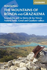 The dramatically situated town of Ronda can make a great base for a walking holiday in the mountains of Andalucía, as can any one of the picturesque 'pueblos blancos' (white villages) that nestle among the surrounding hills. This guidebook presents 32 mainly circular walks in the Ronda region, covering the town and its environs, the Natural Parks of La Sierra de Grazalema and La Sierra de las Nieves (both UNESCO biosphere reserves), and the Genal and Guadiaro Valleys. Clear route description is illustrated with mapping, and the route summary table and 'at a glance' information boxes make it easy to choose the right walk.
Buy a printed or eBook copy online direct from publishers Walking the Mountains of Ronda and Grazalema.