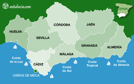
If you are considering visiting Caños de Meca you may find our maps a useful tool, we provide three maps, one of the region of Andalucia with Caños de Meca highlighted.
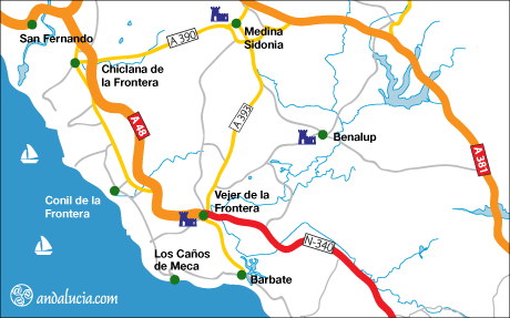
The second handcrafted map gives the location of Caños de Meca with the corresponding local road network.
In order to help our readers we have also embedded a Google map which is centered on Caños de Meca.
On Andalucia.com we use Google Maps service, you can view basic or custom maps of the 8 main provinces of Andalucia, its coasts and major villages. Click and drag maps to view adjacent sections immediately. View satellite images of your desired location that you can zoom and pan.
You can navigate (move your view) in two dimensions in any Google Map. To pan (move the map), do one of the following: click and drag the map or use the arrows on the top left corner of the map.