Final Push Along the Western Flank to the Summit of Mulhacen |
|
Mt. mulhacen - a guide to reaching the summit
Standing at an impressive 3,482m above sea level, situated in the Sierra Nevada National Park, Mt. Mulhacen is the highest mountain in mainland Spain. The mountain is named after the 15th-century ruler of Granada Abu l-Hasan Ali, or Muley Hacén as he was known in Spanish. According to legend he was buried on the mountain's peak.
climbing the mountain
There are four main routes up the mountain, three of which start from the south in the Alpujarras, all of varying technical levels. This means that the climb is suitable for everyone, from the casual hiker to the more experienced mountaineer. You can follow paths from Granada city, the Sierra Nevada Ski Station, Capileira (Alpujarras), or the village of Trevelez (Alpujarras). Alternatively, you can catch a bus from Capileira to 2,700m above sea level, reducing the climb to half a day's walk. Mobile phone networks provide coverage for most of the walk.
Mountain accommodation
Refugio Poqueira (2500m)
This is a popular stop-off for those hiking from Capileira or Trevelez and is just over an hour's walk from where the bus stops. This refugio, located at 2500m, offers shared dormitory accommodation, making it a popular stop-off before the final ascent for those taking two days to complete the climb.
The refugio boasts spectacular views down the Poqueira valley and across to Africa on a clear day. Facilities include providing hot meals, snacks, drinks, toilet and shower facilities, crampon rental and, like many refugios, an abundance of board games to keep you occupied.
A bed for the night costs 17 euro for non-members but is significantly cheaper for those who sign up to be a member of the 'Club Poqueira', worthwhile if you're planning a few trips up the mountain. Impressively, there is free wifi here.
Albergue Universitario (2550m)
This hostel in Hoya de la Mora is larger than Refugio Poqueira and offers individual, as well as shared rooms. There is access via a road from the Sierra Nevada Ski Station and the refugio offers parking and other facilities you'd expect to find in a basic hotel, like wifi, lounge area and a games room. From here one can take ski classes and other activities such as hiking with a guide.
Refugio de Caldera (3050m)
This refugio can be found on the Western Ridge and sleeps 16-20 comfortably. This is an unguarded shelter without facilities like water, however there is a corrie next to the shelter providing untreated water. Booking is not necessary and a stay here is free. The refugio offers hikers shelter from the elements, with a fireplace for those especially cold nights. If staying here, be sure to keep the door closed at all times to prevent snow or foxes from entering and remeber to take all rubbish with you.
the routes
from capileira
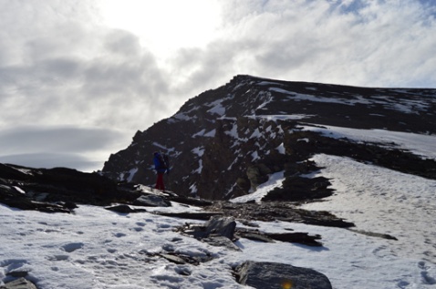
Starting at the foot of the path in Capileira, this route passes through pine forests and vast open mountain landscapes until reaching the Refugio Poqueira. After a night's rest, one can either take the more technically challenging Western Flank to the summit (where crampons are recommended) or ascend via the South Ridge, which takes a little longer but is just walking, as opposed to climbing.
A recommended route would be to ascend via the more exposed Western Flank and descend down the South Ridge. Allow two days to complete the summit and descent.

from trevelez
This route starts in the pretty village of Trevelez to the west of Capileira and the track also arrives at the Refugio, however, the walk is 1-2 hours longer. As stated above, after a night's sleep, one can ascend via one of two main routes.
taking the bus
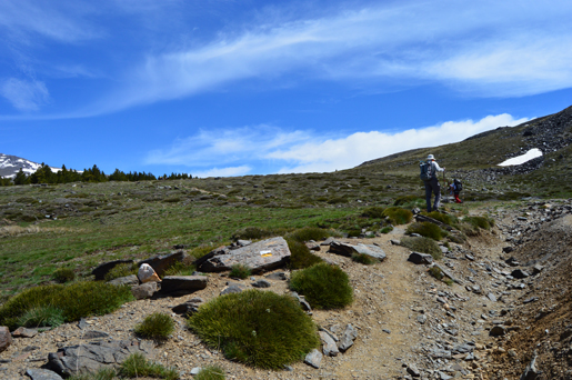
During the summer only, there is a bus service that takes you from Capileira to the Mirador Trevelez at 2700m. From here you can walk to the summit in 2-3 hours via the less challenging South Ridge. The bus must be booked in advance at the tourist information centre in Capileira. See their site.
from granada
There is a road, popular among cyclists, that starts in Granada City and winds up to the Sierra Nevada Ski Station before continuing on to meet the Western Flank route. The road passes the Albergue Universitario (2550m) on the Hoya de la Mora where one can spend the night or enjoy a hot meal or snack. A bus runs in the summer months taking hikers as far as Posiciones del Veleta (3100m), from where it is roughly four hours' walk to the summit.
Do I need a license or a guide?
No, anyone can do the walk regardless of experience or expertise. Guides are available through private companies and are excellent for those who don't want to worry about map-reading or are unfamiliar with the area, however they are not compulsory. Equally, no licence is required, neither does it cost anything to climb to the summit. If you are planning to stay in one of the refugios then you may need to book your room/bed in advance to ensure that you are not turned away when you arrive.
clothing
Mt. Mulhacen is a mountain nearly 3,500m high, and therefore, regardless of the weather below, you should prepare for poor weather conditions higher up. During the summer months there may still be snow, rain and high winds on the peaks so take warm, waterproof clothing. It is advisable to pack crampons, even if you will summit via the Southern Ridge, just in case.
If you are climbing the mountain in the winter then crampons should be packed to ensure safe crossings over snow and ice. During the colder months, weather conditions can turn quickly and so warm, waterproof clothing with many layers is always essential.
Sturdy walking boots offer essential grip and good ankle support, equally they are able to accommodate crampons comfortably. Sun glasses should be worn all year round to protect eyes from the powerful rays and snow glare, as should suncream. With wind and cold weather at the higher altitudes, it is easy to be unaware of the sun's powerful effects.
Have a great, safe hike up to mainland Spain's highest peak!
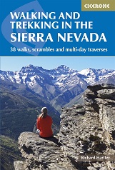
Walking and Trekking in the Sierra Nevada" by Richard Hartley
BuyWalking and Trekking in the Sierra Nevada" by Richard Hartley
 This guidebook presents 33 graded walks and 5 high mountain scrambles in the striking Sierra Nevada, the highest mountain range in mainland Spain and in western Europe outside the Alps. Easily accessible from Granada and Málaga, it is a world of soaring, snow-clad peaks and deep valleys, far removed from the crowded beaches of the Costa del Sol just two hours away. The routes are spread across the national park, with attractive towns and villages such as Trevélez, Lanjarón, Hoya de la Mora and Cumbres Verdes serving as potential bases for a walking holiday
The guide also includes advice on transport, bases and safety, a tick-list of the 3000m peaks and a Spanish-English glossary. There is the option to buy a printed book, an eBook, or both as one deal.
Buy a copy online of Walking in the Sierra Nevada