Cabo de Gata coast road |
|
Driving Route along Cabo de Gato coastal road
Driving Route along the Cabo de Gata Coast, Almería
Set off on a journey through one of Spain’s most unspoiled and captivating coastal landscapes—the Cabo de Gata-Níjar Natural Park in Almería. This rugged stretch of southeastern coastline is a rare gem, where volcanic cliffs, hidden coves, and shimmering turquoise waters meet desert-like plains and sleepy whitewashed villages.
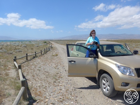
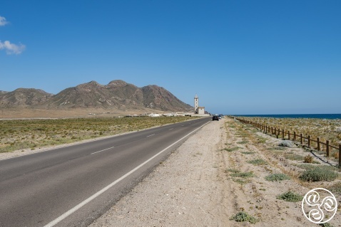
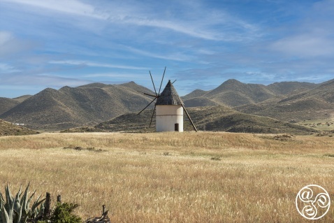
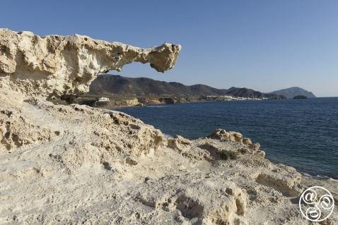
As you wind your way along the coast, you’ll find countless opportunities to pause and soak in the views—perfect for photographers and nature lovers alike. From the striking silhouette of the Molino at Pozo de los Frailes, a beautifully preserved traditional windmill, to the otherworldly rock formations of the Arrecife de las Sirenas (Mermaid’s Reef), this route offers dramatic scenery at every turn. The coastline’s jagged beauty and serene charm make this drive feel like a step back in time—far removed from the bustle of modern tourism. The route is in two parts since motor vehicles are not permitted on a small section of the old coast road.
Part 1 - Starting point the village of San Miguel
The route will take you from the village of San Miguel east to Cabo de Gata headland.
To reach San Miguel, take the AL-12 coast road eastwards from Almeria city or Almeria Airport and on reaching Retamar turn right onto the AL-3115. At the roundabout just before Ruescas turn right continuing on the AL-3115. When you reach a built up area on the coast you are in the small village of San Miguel.
Starting from the village of San Miguel, from the 'Cabo de Gata' moasaic roundabout, take the AL-3115 eastwards along the coast look out on the left for the salt pans Salinas de Acosta, a vast 4km-long wetland created by a lagoon with blindingly white mounds of salt heaped up. Here you can see the ruins of an old village; the size of the church gives an idea of how important the salt industry must have been. Salt has been extracted from here for centuries since Phoenician times. Just 3km after the San Miguel stone tower and on the left opposite a metal lookout tower on the beach is a dirt track that leads to a bird hide. You'll find it about 150m down the track from the beach, across the sand dunes.
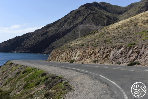
The road then climbs steeply; look out for the ospreys nesting in the cliffs above the road, as well as peregrines, kestrels and eagles. The next cove is dominated by a lighthouse (faro). Legend has it that sailors mistook the sound of monk seals for mermaids on this headland so they called it the Arrecife de las Sirenas (the Reef of the Mermaids) Mermaids Reef - Arrecife de las Sirenas is one of the most iconic and magical spots in Cabo de Gata-Níjar Natural Park, located in Almería, Spain. Crystal-clear waters, dramatic rock formations, and a unique undersea landscape make it a paradise for a photo stop. There is a viewpoint is located just off the main road—offering a stunning panoramic view of the reef, perfect for capturing this and wild stretch of Mediterranean coastline. From the hills of San Miguel and Vela Blanca, where there is an 18th-century watchtower, are some of the park's most magnificent panoramic views. You can see as far as North Africa on clear days, as well as the Salinas and along the coast. This is one of the main Capes or Peninsular demarking the Spanish Mediterranean coastline.
There is a car park at the Cabo de Gata cape and lighthouse and access to a viewpoint looking down to Arrecife de las Sirenas. (Mermaid's reef) which is a good place to spot offshore seabirds such as razorbills, shags, cormorants, gannets and gulls.
The road carries on to the next headland but a barrier prevents vehicles from continuing. However, you can take a very enjoyable walk or cycle from here, 8 km along a dirt track to the village of San José.
Part 2 - Starting point the village of San José
The route will take you from the village of San José east to Playa de los Muertos.
To reach San José, take the AL-12 coast road eastwards from Almeria city or Almeria Airport and on reaching Retamar turn right onto the AL-3115. At the roundabout just before Ruescas turn left through Ruescas on the AL-3201 and then after a few km turn right AL-3108 to San José passing through the hamlet called Pozo de los Frailes.
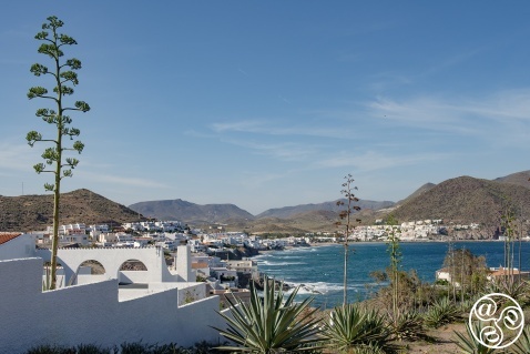
By car this is a mainly inland route, which nonetheless visits the Cabo de Gata's principal beach resort of San José and a few other beaches, with fine views along this rugged stretch of coastline. San José has a popular beach, alternatively you can walk around the headland west of town to Playa de los Genoveses.
Heading north to reach the next beach hamlet, Los Escullos, by car the AL-3108 road is inland. There is a park info point point at Pozo de los Frailes and a restored water wheel. The route turns right onto the AL-4200 for Los Escullos. Look out for the fort, unusual rock formations on the beach and a couple of hosteleries and the legendary forced to closed Bar de Jo. One kilometer further on, the tiny picturesque fishing village of La Isleta del Moro with more seafront cafe bars.
The road climbs beyond La Isleta to a viewpoint with superb views along this stretch of coastline, before turning inland again to Rodalquilar, a former gold mining centre and now with some abandoned houses. The mine has been closed since the mid-1960s, causing a population decline in the village. There is a botanical garden here, El Abardinal, displaying an excellent variety of plants that grow in the park.
One kilometre later, take the 2km-long track that heads right towards the coast. There is a fine sandy beach, El Playazo, and the Castillo de San Ramón, another 18th-century lookout tower. Back on the main road, you can take the (AL-3106) detour to Las Negras, with its pebble beach, before continuing north. Take a left for a detour to view the infamous Cortijo del Fraile. Take a right at Fernan Pérez, along a narrow paved country road which will bring you on to the AL-5106 that leads to Agua Amarga, one of the most attractive resorts in Cabo de Gata and its northernmost village protected by a headland and its remarkable derelict mineral loader.
Three kilometres north of Agua Amarga is turning to climb up the flat-topped extinct volcano of Mesa Roldan complete with a lighthouse and fort used as a location for Game of Thrones. A little further on is a great spot for views from the clifftop Mirador Punta de los Muertos on the headland. There is a car park here and you can walk down to the Playa de los Muertos. The coast road continues north through Carboneras and switchback climb to Mojacar.
Travelling this coast by car allows you to explore at your own pace—stopping at viewpoints, stretching your legs on clifftop paths, and discovering tucked-away beaches. Best of all, it gives you the chance to note your favourite places to return to—perhaps for a sunset swim, a longer hike, or simply another chance to indulge in the peace of this untouched corner of Andalucia.
